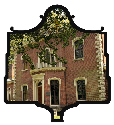
“Under Vine Street flows the Town Branch of Elkhorn, the stream upon whose banks Lexington was established in 1779. Used in the early days to bring merchandise to Lexington from Ohio River. On Town Branch was launched Edward West’s steamboat in 1793. Heavy floods troubled Lexington until a large underground channel built in 1930s.”
Presented by Lexington-Fayette Co. Historic Commission
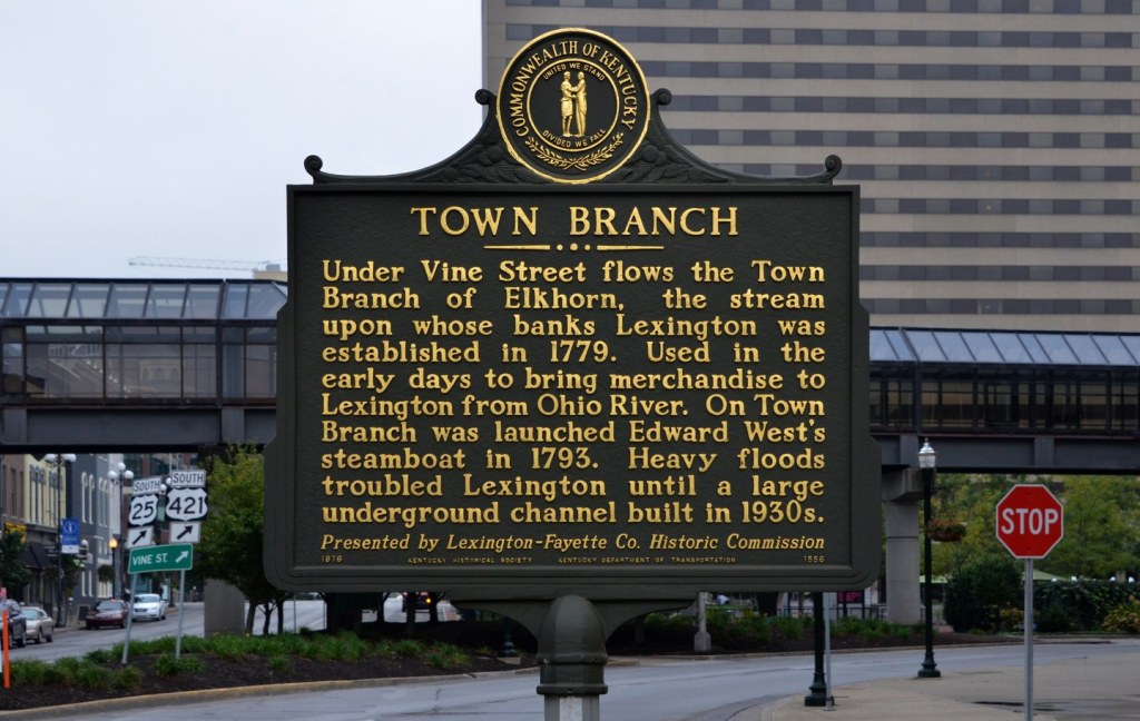
Kentucky Historical Society, Marker No. 1556 — erected 1976
West Main St., Central Bank Center parking lot, Lexington | 38° 03′ 00″ N, 84° 30′ 05″ W — Directions: MapQuest
Most people who pass this marker are walking to a game at Rupp Arena or a concert or to a convention, and few of them give a thought to waterways. There are none in sight. Yet the marker is about a creek, and the creek is still here, flowing in the dark beneath the pavement a short distance away. It is the reason Lexington sits where it does. It also gave the young town water power, a sewer, epidemics, and floods. Then Lexington spent a century and a half covering it up.
The marker packs a great deal into four sentences, and two of them need a closer look. But the larger story, of a town that grew up around a stream and then buried it, is better than anything on the plaque.
A Town Built on a Creek
Town Branch begins at springs on the east side of Lexington and runs west and northwest through the city, joining South Elkhorn Creek near the Woodford County line. From there its water travels by way of Elkhorn Creek and the Kentucky River to the Ohio.
In June 1775, a party of hunters camped at a spring west of here. When they heard news of the fighting at Lexington, Massachusetts, they named the place after it. Nobody settled until April 1779, when Robert Patterson and a party of men from Harrodsburg built a blockhouse near the creek, close to where Main and Mill streets meet today. The availability of water decided the location. A fort needed a reliable supply, and the branch and its springs provided one.
When the town was laid out, the creek ran through a strip of public land called the Commons, open to everyone for water, washing, and livestock. In 1790 the town trustees decided to dig a straight canal to carry the branch through the center of town, with locust trees planted along each side. In 1797 they ordered it straightened again and widened to sixteen feet. The street along it became Water Street. In other words, Lexington began engineering its creek almost as soon as it had one.
The branch soon went to work. John Cocke built a grist mill on it in 1788, often called the first water mill in Kentucky. Tanyards (where animal hides were soaked and cured into leather), a hat factory, woolen and paper mills, ropewalks, a brewery, and distilleries followed. Elijah Culpepper is said to have run a still beside the creek as early as 1780. West of town, the mill village of Manchester grew up along the banks after 1805. It later became the center of Lexington’s distilling industry, and it came to be known as Irishtown for the immigrants who worked in its mills and on the railroad. Much of the hemp that made early Lexington rich was spun and woven into rope and bagging by enslaved people in factories near the creek.
Merchandise from the Ohio River?
The marker says the creek was “used in the early days to bring merchandise to Lexington from Ohio River.” This is the claim that holds up least well.
Town Branch was never navigable in any practical sense. A history prepared for Gatton Park describes it as “hardly big enough to float a canoe” except in flood. Even then, water flows downhill, away from Lexington and toward the Ohio. Nothing heavy came upstream.
Goods reached early Lexington the hard way. Merchants bought their stock in Philadelphia or Baltimore and had it hauled over the mountains to Pittsburgh. From there it went by flatboat down the Ohio to Limestone, now Maysville, the river landing that served as central Kentucky’s front door, and then by wagon about sixty miles south to Lexington. Outbound trade ran in reverse: hemp, tobacco, flour, and whiskey went by wagon to landings on the Kentucky River or to the Ohio, then by flatboat to New Orleans. Lexington’s lack of a usable waterway was one of its biggest economic handicaps. It is a large part of why Louisville and Cincinnati, sitting on the Ohio, overtook it after steamboats began running upriver in the 1810s. The Lexington and Ohio Railroad, chartered in 1830, was meant to solve the problem by laying track all the way to the Ohio at Louisville. It reached Frankfort in 1834, but the line never made it to the river.
It is possible that the marker’s writers had in mind the creek’s connection by water to the Ohio, or the occasional small boat floated down it in high water. But as a description of how merchandise came to Lexington, the marker gets it wrong.
Edward West’s Steamboat
The marker’s next claim, that “on Town Branch was launched Edward West’s steamboat in 1793,” is true in a narrower sense than it sounds.
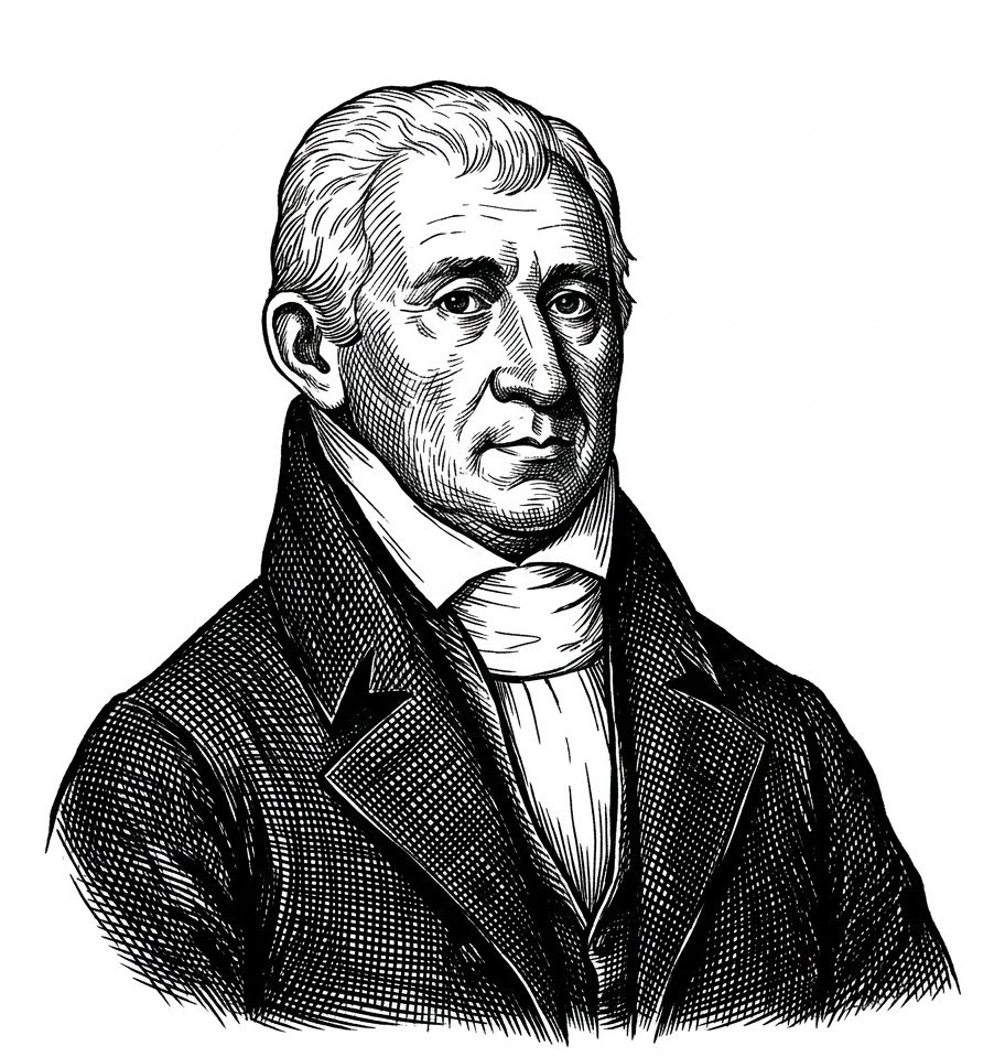
Edward West was a real and remarkable Lexington craftsman. Born in Virginia in 1757, he worked in Lexington as a silversmith, clock and watchmaker, and gunsmith, and he was a tinkerer of the first order. His son, William Edward West, became a well-known portrait painter.
The source for the 1793 date is Robert Peter’s History of Fayette County, published in 1882, almost ninety years after the event. Peter wrote that West tested a steam-driven boat on the town fork of Elkhorn, which had to be dammed to give it enough water to float. He believed this was “in all reasonable probability” the first steamboat ever invented. The best description of the boat itself comes from Thomas Barlow, a Lexington inventor who knew West. Barlow said the engine had a two-inch cylinder, and that “the boat was not big enough for a man to get in.” In other words, West’s boat was a small working prototype, not a vessel anyone could ride.
That does not make it unimportant. West received a federal patent for a steam engine on July 6, 1802, along with patents for a gun lock (the firing mechanism of a musket or rifle) and a nail-cutting machine. The patent models were later destroyed in a fire at the Patent Office, but a model of his steam engine survives in the collections of the Kentucky Historical Society. In 1816, according to a history of West’s career, a steamboat built on his plan left Hickman Creek in Jessamine County bound for New Orleans. It never came back.
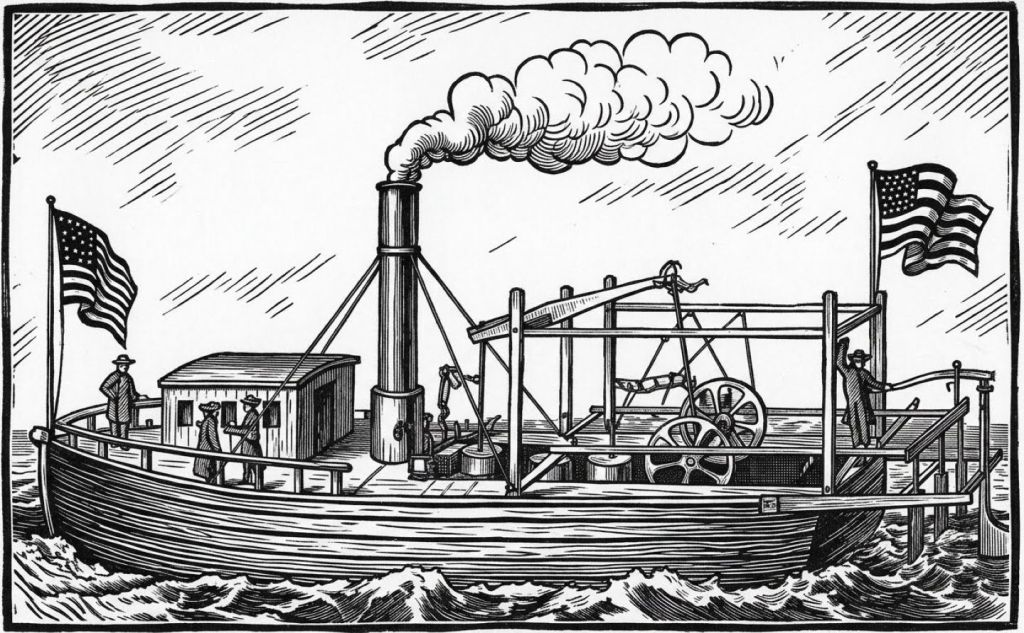
The larger claim, that Lexington invented the steamboat, needs care. John Fitch was running steamboats on the Delaware River in 1787 and 1790, well before 1793, and James Rumsey demonstrated one on the Potomac in 1787. Robert Fulton’s Clermont, the first commercially successful American steamboat, came in 1807. West belongs among the many inventors working on the same problem in those years. What sets him apart is where he did it: in a landlocked town, on a creek that had to be dammed to float a prototype. West made his money from the nail machine. He died in Lexington in 1827.
An Open Sewer
As Lexington grew, the creek that gave it life became its drain. Privies, stables, slaughterhouses, tanneries, and distilleries all emptied into the branch, and so did the streets every time it rained. There was no treatment of any kind. Through the nineteenth century the town covered the stream piece by piece. Sections were arched over with brick and stone, and buildings, a market house, and railroad warehouses were built directly on top. By the 1890s, maps show almost no open water downtown.
Covering the creek did not clean it. In the summer of 1833, Asiatic cholera reached Lexington and killed about 500 people in a few weeks, out of a population of around 6,000. A second epidemic in 1849 killed more than 300. Doctors of the time did not know that cholera spreads through contaminated water, but the town’s wells and its creek were part of the same polluted ground. Burial grounds overflowed, one reason the Lexington Cemetery was established in 1849, a story told in the Lexington Cemetery article.
Newspapers in the 1880s and 1890s regularly denounced the condition of the branch. A sanitary sewer system finally arrived in 1918. But the old creek channel was still carrying both storm water and sewage, and it was too small for either.
The Floods and the 1930s Channel
The marker is right that floods troubled Lexington. On July 7, 1923, a summer cloudburst left a foot of water at Main and Broadway, and one newspaper columnist quipped, “So this is Venice!” On June 28 and 29, 1928, more than five inches of rain turned Main Street into a river three feet deep. The Herald called it “the most disastrous flood in the history of this section,” and estimates of the damage ran into the millions. On August 1 and 2, 1932, seven and a half inches fell in seven hours. Losses in the city topped a million dollars, and out in the county six people drowned when Hickman Creek swept a house off its foundation.
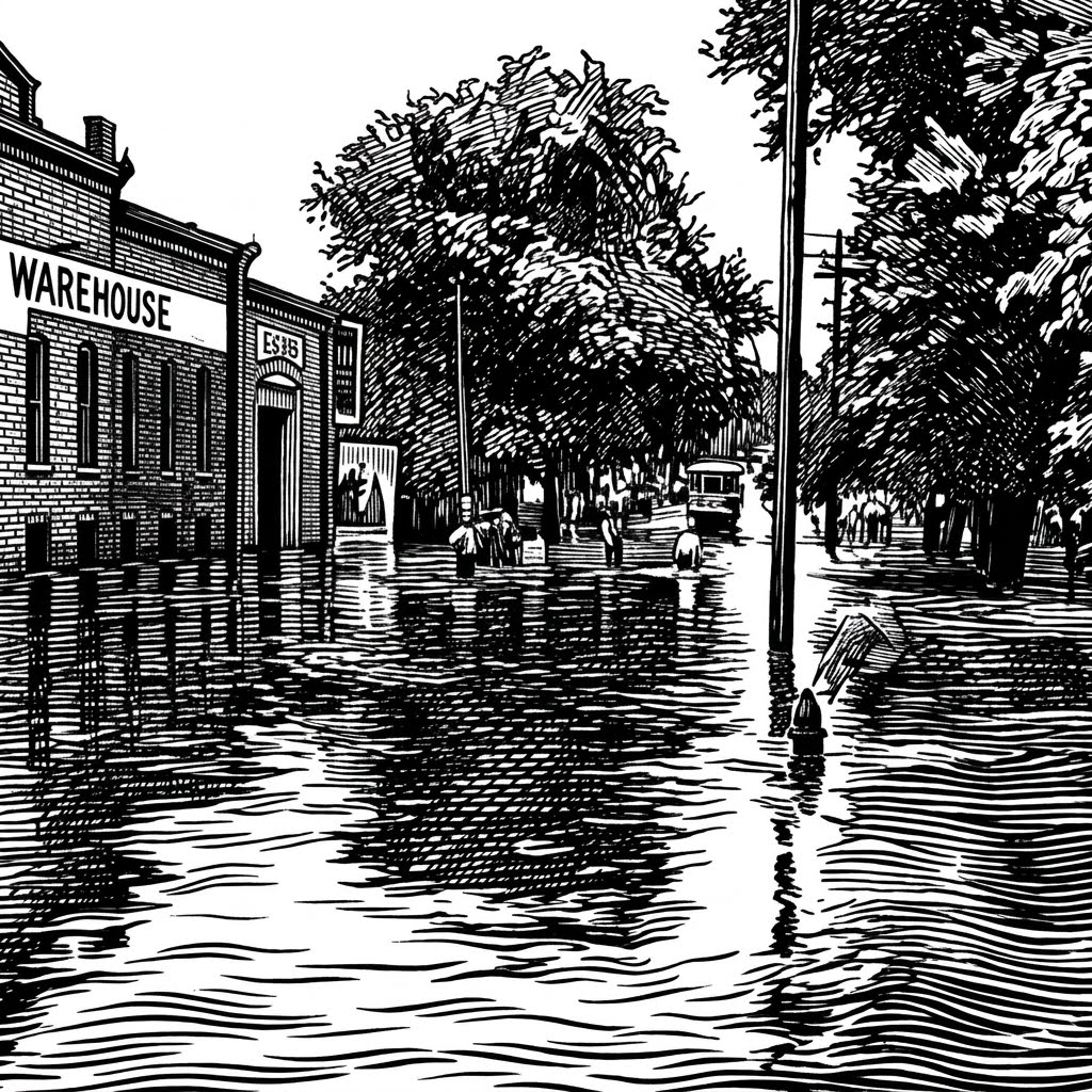
The underground channel the marker mentions came out of the Great Depression. Work on a new Town Branch channel began under the Civil Works Administration, a short-lived federal jobs program, in the winter of 1933 to 1934. It stopped when that program ended. On May 4, 1934, the Lexington Herald reported that the federal government had authorized “a resumption of the work on the Town Branch channel.” Construction of a large brick barrel vault resumed that month, and over 1934 and 1935, federal relief money paid to separate storm sewers from sanitary sewers and to build a much larger culvert through the Vine Street corridor.
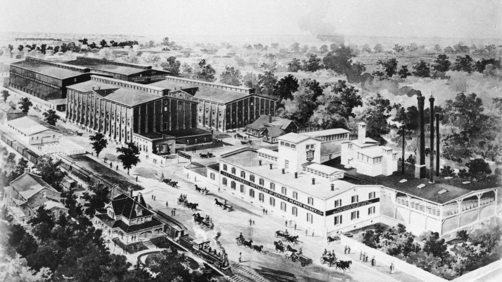
One more episode from that same spring shows just how much the buried creek still carried. On Saturday, April 28, 1934, a fire broke out at the James E. Pepper Distillery on Manchester Street, beside the creek west of downtown, and thousands of gallons of whiskey poured into Town Branch. Four days later, an Associated Press story reported that every fish in Elkhorn Creek near Weisenberger’s Mill in Woodford County was drunk. The fish were floating at the surface, “very much alive but in a stupor,” and local people were scooping them up by the bagful with rakes and pitchforks. Weisenberger Mill, owned by the same family since 1865, still grinds flour and meal there today.
The new channel ended the worst of the downtown flooding. It did not end the creek’s troubles. Combined and leaking sewers kept fouling Town Branch for decades, and in recent years a federal consent decree with the Environmental Protection Agency has required Lexington to spend hundreds of millions of dollars rebuilding its sewer system, work that is still being finished.
Under Vine Street, and Back into the Light
The railroad tracks that once ran along the old Water Street corridor were later removed, and the wide street built in their place is today’s Vine Street. That is why the marker can say, accurately, that the creek flows “under Vine Street.” The marker itself, though, does not stand on Vine. It sits a block south on West Main, at the edge of the arena parking lot, close to where the buried creek passes beneath the Rupp Arena and convention center complex. The Mary Todd Lincoln House stands a block to the west.
Downstream, the creek’s banks were home to working neighborhoods that the rest of the city often overlooked. Davis Bottom, south of the creek along the railroad, grew after the Civil War when a landowner sold lots to Black families, and it became a mixed-race neighborhood of factory and rail workers living in a low, flood-prone hollow. Much of it was cleared in the early 2000s for the Newtown Pike extension, now Oliver Lewis Way.
In the last few years, after a century and a half of burying Town Branch, Lexington has started to bring it back. The Town Branch Commons trail, a linear park through downtown along the creek’s route, opened in 2022. On August 23, 2025, Gatton Park on the Town Branch opened behind Rupp Arena on what had been a parking lot. There, the creek leaves its culvert and runs in the open again for the first time in generations. During construction, workers found a stone wall dating to around 1790, from the trustees’ first attempts to tame the stream. They took it apart stone by stone and rebuilt it beside the new channel.
So the marker’s first sentence is still the truest one. Lexington was established on the banks of this stream. For most of its history, the town worked hard to forget that. Now, a few hundred feet from this marker, you can stand on a bank and watch it flow again.
Sources consulted: Kentucky Historical Society marker database, Marker No. 1556; Historical Marker Database (hmdb.org), entry 58557; Gatton Park on the Town Branch, “Town Branch: History of the Creek” (2025); “The Disappearance of Town Branch,” University of Kentucky geography paper (2001); Margaret M. Bridwell, “Edward West, Silversmith and Inventor,” Filson Club History Quarterly (1947); Robert Peter, History of Fayette County, Kentucky (1882); Smiley Pete Publishing, “A Creek Runs under It” (2012); The Lexington Times, “‘So This Is Venice!’” (2026); WKYT, “How the Town Branch Impacted Lexington’s History” (2025); WEKU, “Gatton Park on Town Branch” (2025); The Lexington Herald, May 4, 1934; The Courier-Journal (Associated Press), May 3, 1934.




I’m eager to hear what you think